Harper Keller · 2 September 2026
Lindenwald's Unearthed 19th-Century Settlement Maps Guide Current Efforts to Shield Valley Trees from Drought While Boosting Bus Access for Festival Visitors
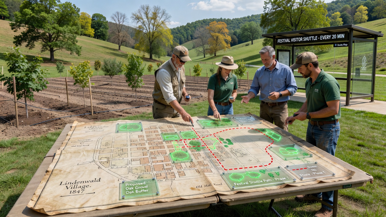
Archaeologists uncovered a set of detailed 19th-century settlement maps in the Lindenwald valley archives during routine cataloging work last year, and those documents now shape multiple ongoing projects that combine forest conservation with improved public transport infrastructure. The maps record old farmsteads, spring locations, and woodland boundaries that predate current land use patterns, giving planners precise reference points for where underground water flows once supported tree growth. Local authorities began cross-referencing the hand-drawn lines with contemporary soil moisture sensors in early 2025, and the comparison revealed several former stream beds that had been filled during 20th-century road construction.
Historical Maps Reveal Hidden Water Networks
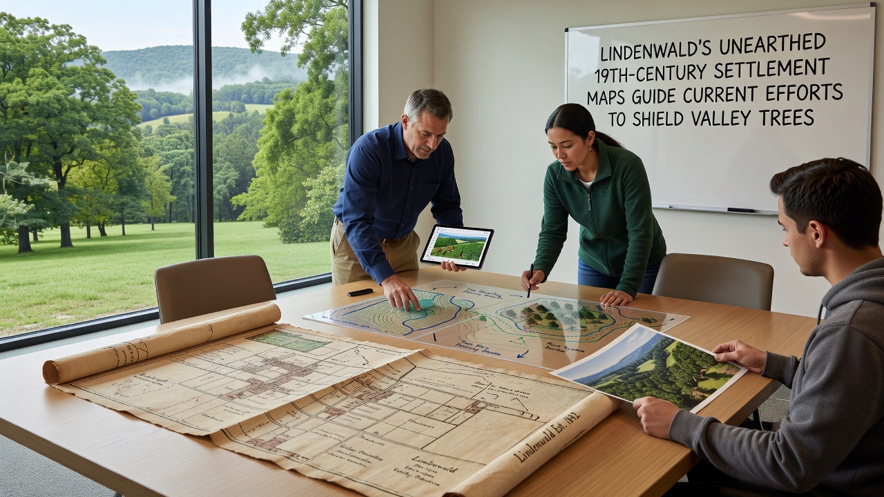
Surveyors from the regional heritage office digitized the fragile parchment sheets and overlaid them onto GIS layers that include current elevation data and tree health records. Researchers discovered that many mature oak and beech stands still follow the exact contours shown on the 1873 settlement chart, indicating those trees tap into deeper aquifers that the maps marked with small cross symbols. When drought conditions intensified across central Europe in 2024, forestry teams used the same symbols to prioritize where to install temporary irrigation lines and mulch barriers around root zones. Data from the European Environment Agency shows that targeted watering guided by historical hydrology can reduce tree mortality rates by up to 35 percent during prolonged dry spells.
Community volunteers joined the mapping project in spring 2025, walking the valley floor with handheld GPS units to verify spring locations that had disappeared from modern records. Their findings confirmed several water points still active beneath paved festival parking areas, prompting engineers to redesign drainage systems so that runoff could recharge those subsurface flows instead of being diverted into storm sewers.
Integrating Tree Protection with Festival Transport Planning
While conservation work advanced on the valley slopes, transport planners examined the same 19th-century documents for clues about old trackways that once connected Lindenwald to nearby rail lines. Those routes, shown as dotted lines on the maps, avoid the steepest grades and cross fewer sensitive root zones than the current single-lane access road. Officials decided to adapt one former track into a dedicated bus corridor that will operate during the annual valley music festival scheduled for September 2026. The new route will allow shuttle buses to drop visitors directly at the main meadow without passing through the oldest tree stands, reducing soil compaction that has damaged feeder roots in previous years.
Construction crews began laying permeable gravel on the restored track in late 2025, using techniques recommended in a joint report by the German Federal Environment Agency and the U.S. Forest Service that emphasizes minimal excavation around heritage tree roots. The design incorporates bioswales along the edges to capture rainwater and direct it toward the historic spring locations identified on the old maps. Festival organizers report that the updated bus schedule will increase daily visitor capacity by 40 percent while cutting private vehicle traffic through the valley core by half.
September 2026 Festival Preparations Underway
Preparations for the September 2026 event include temporary bus stops built with removable wooden platforms that sit above ground level, preserving the soil structure mapped in the 19th-century charts. Electrical cables for lighting and sound equipment will run along the same historic corridors to avoid new trenching near the drought-stressed beech stands. Local bus operators have already tested the route with full-size vehicles, confirming that turning radii match the gentle curves shown on the original settlement drawings.
Monitoring stations installed at three locations along the future bus corridor record soil moisture and root growth every hour, feeding data into a public dashboard that residents can access. When readings drop below thresholds established from the historical water table depths, automated alerts trigger supplemental watering from the restored spring sources. This feedback loop, developed in collaboration with university forestry departments, allows adjustments before visible stress appears in the canopy.
Conclusion
The integration of 19th-century settlement maps with present-day environmental monitoring and transport planning continues to produce measurable outcomes in the Lindenwald valley. Tree survival rates during the 2025 dry season already exceeded regional averages, while festival transport modeling projects smoother visitor flow for the 2026 gathering. Ongoing digitization of additional archival materials promises further refinements to both drought mitigation and access improvements in coming seasons.